Plan for Victoria Maps
Department of Transport and Planning
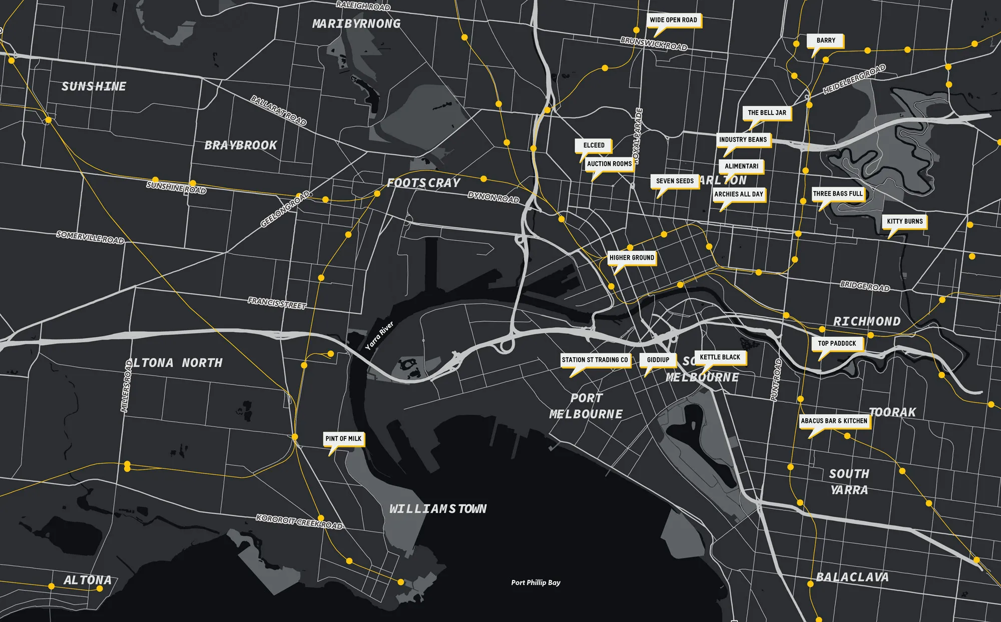
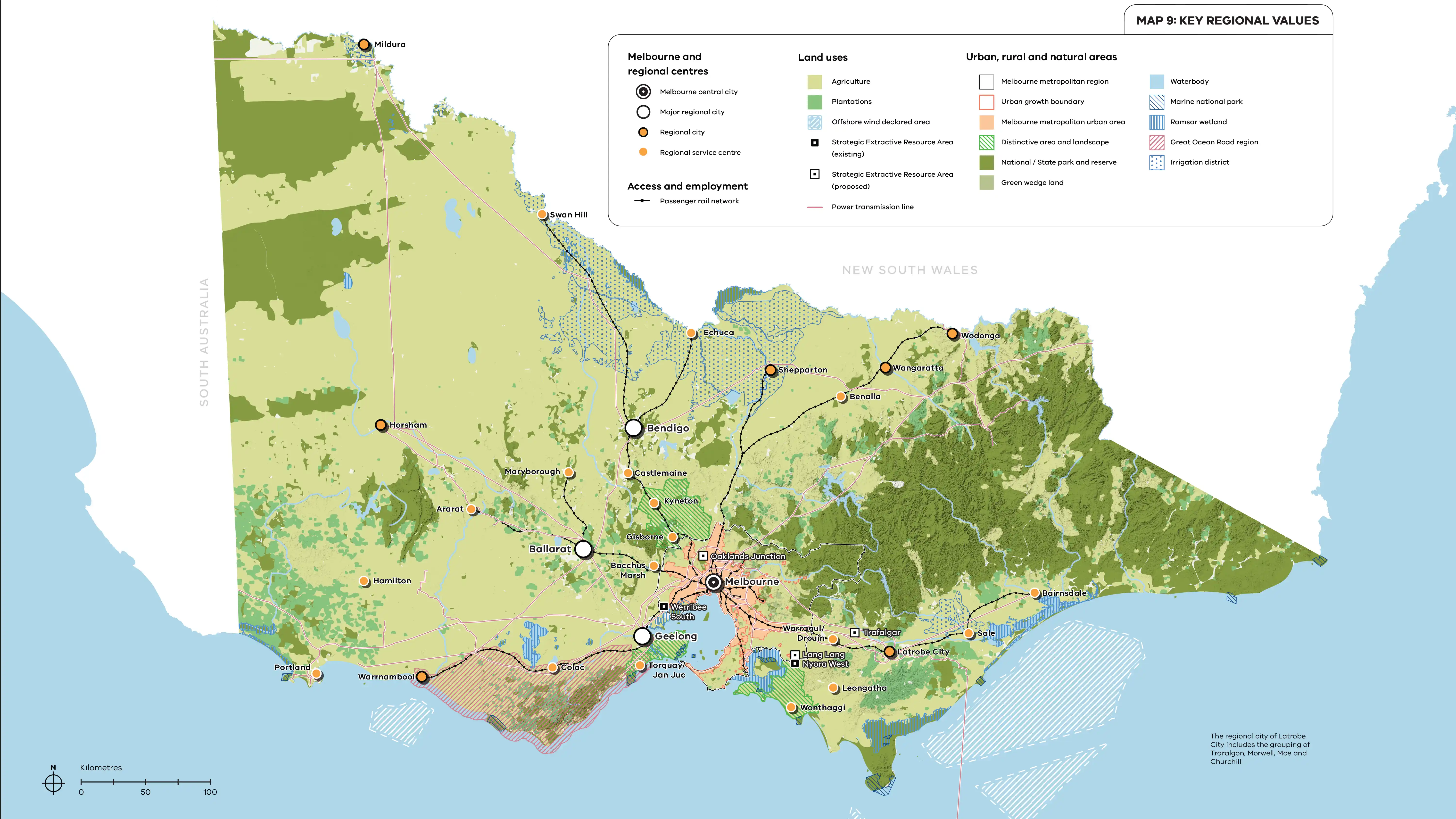
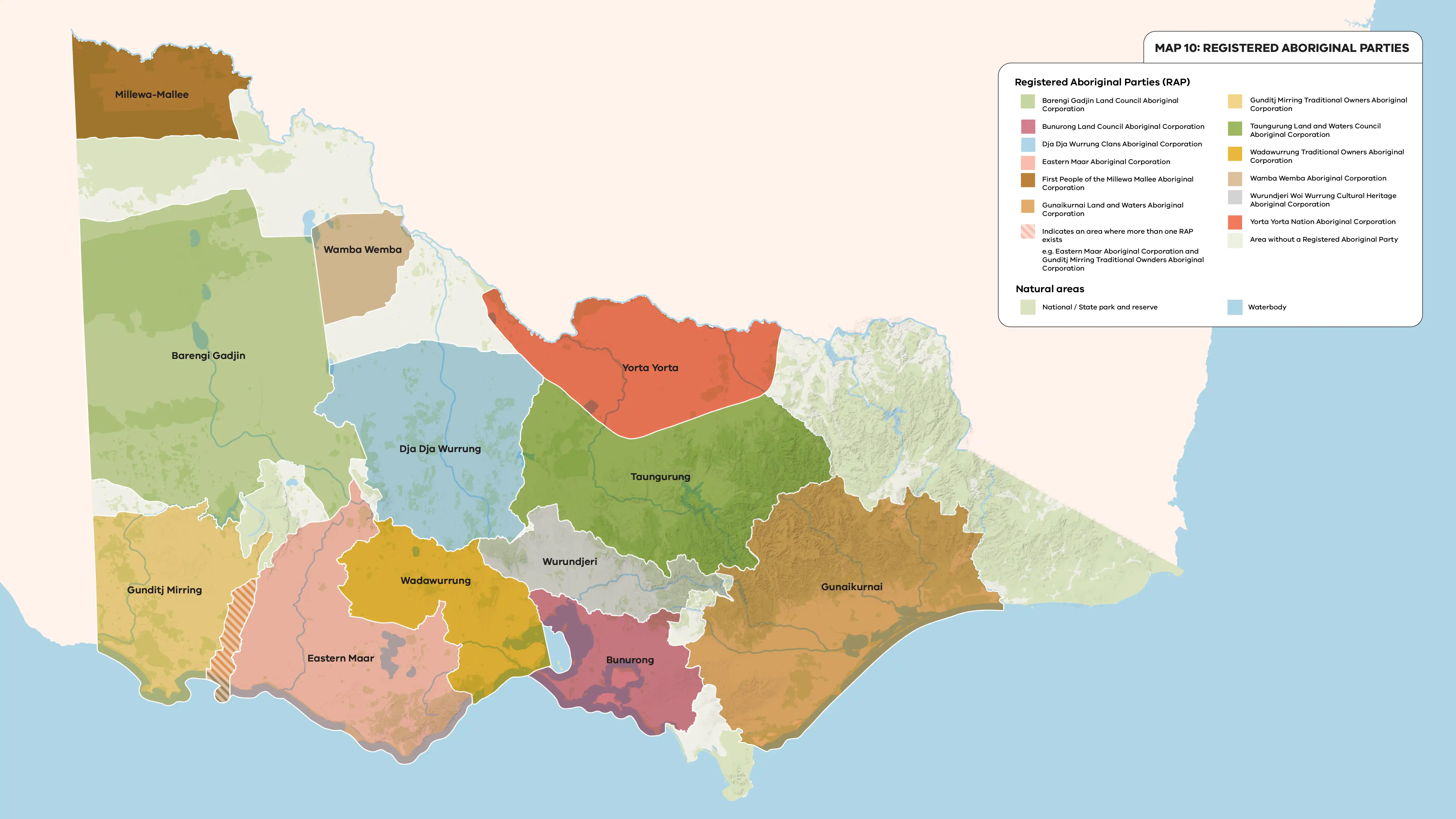
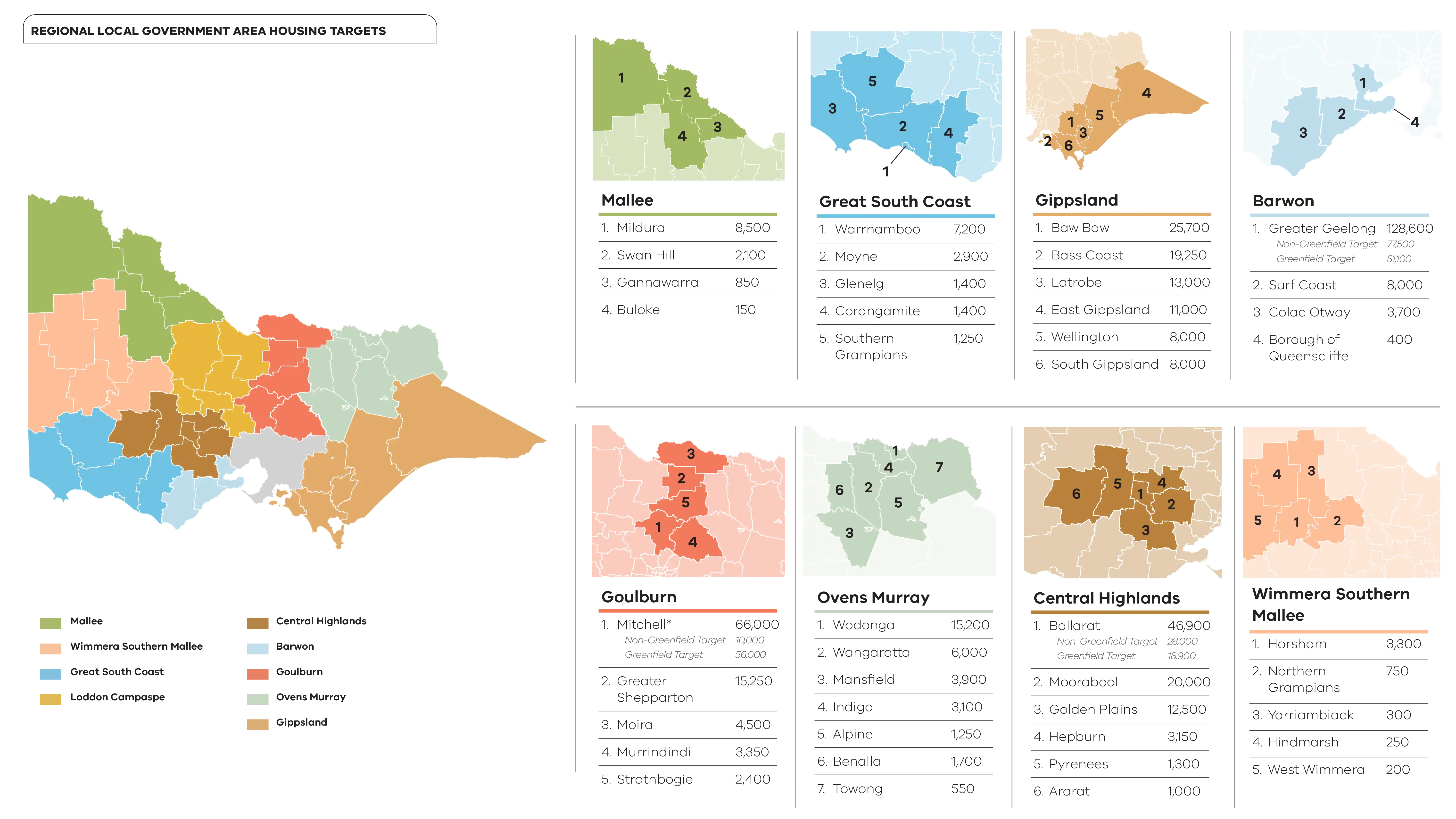
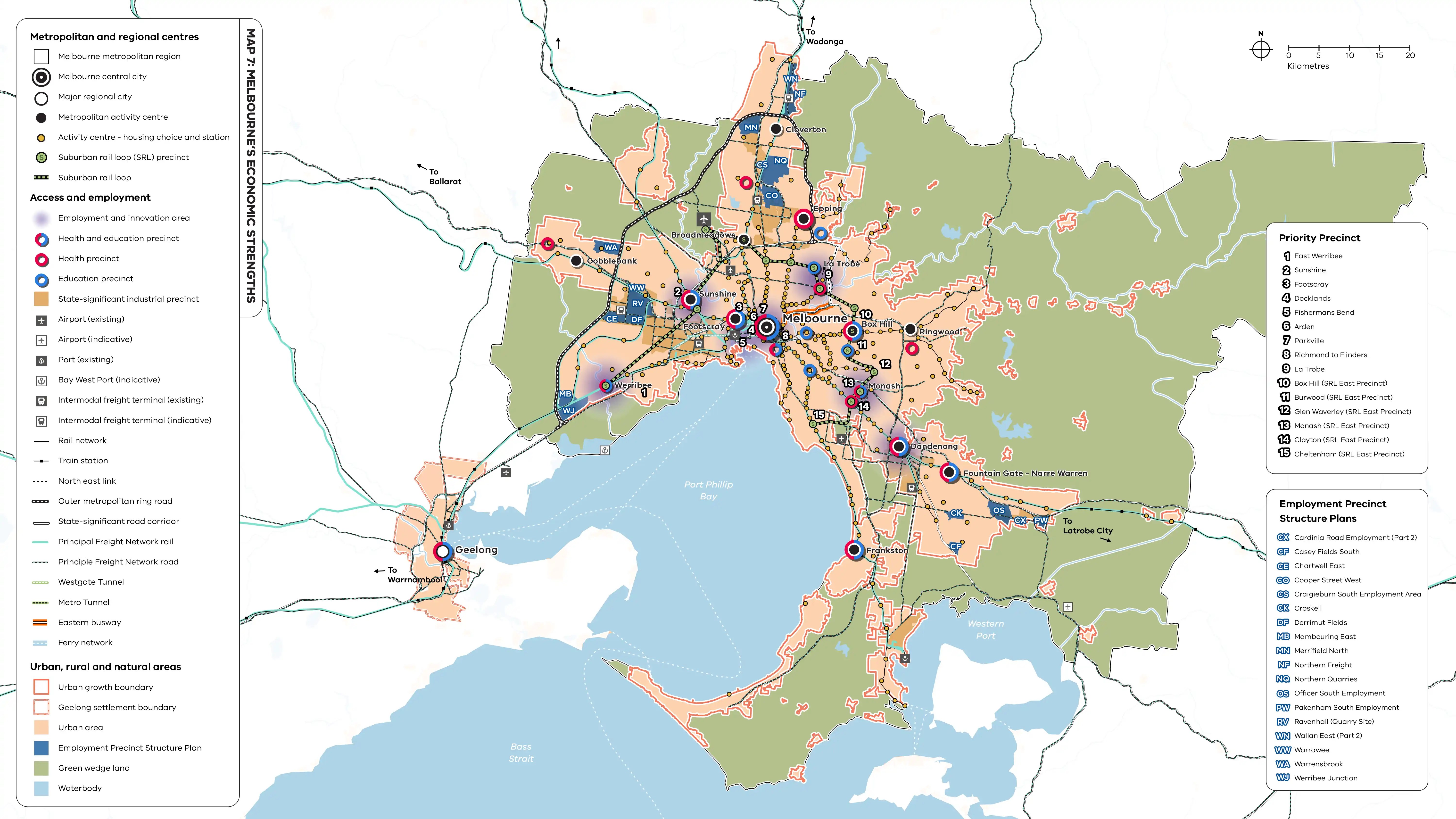
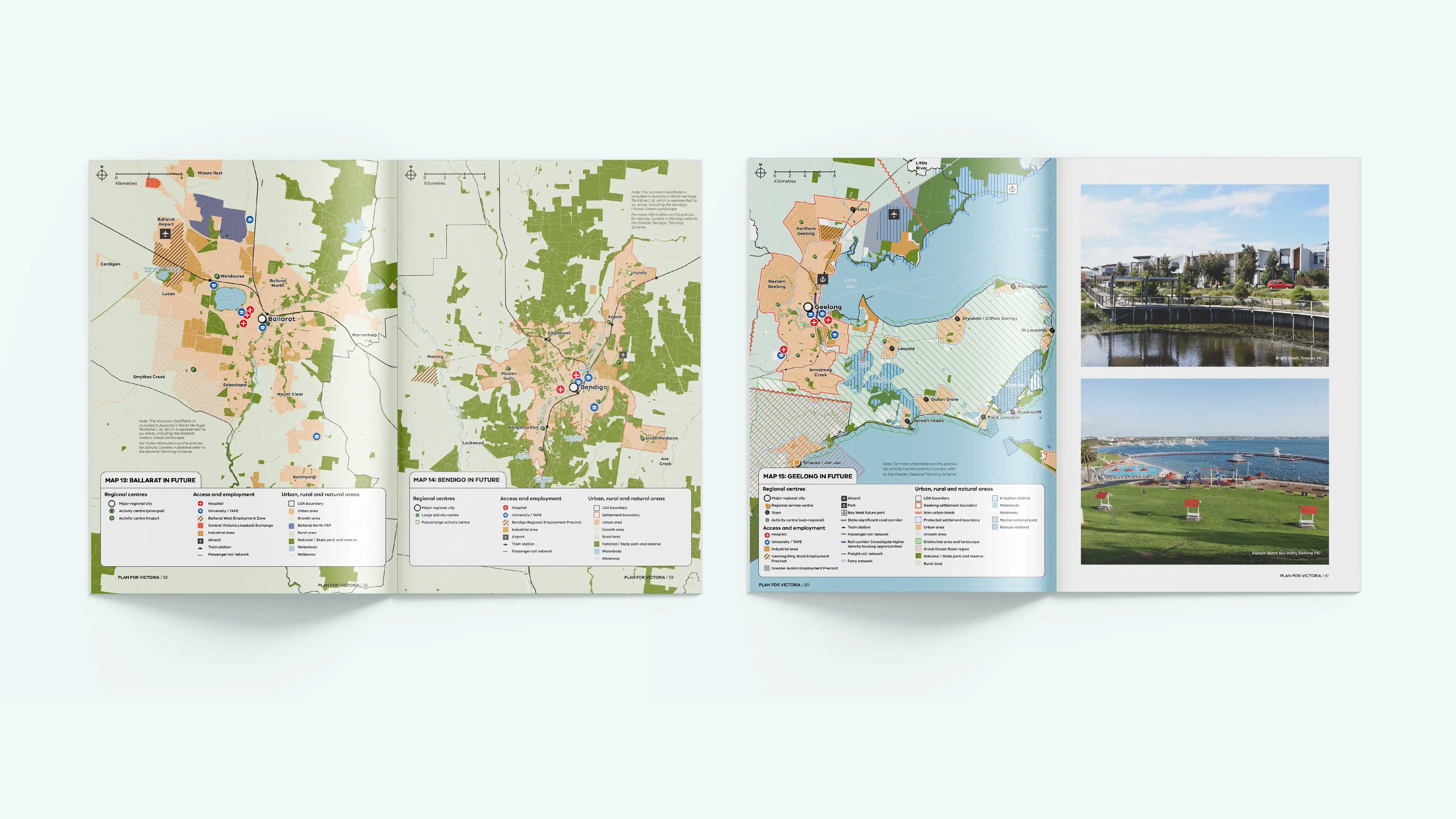
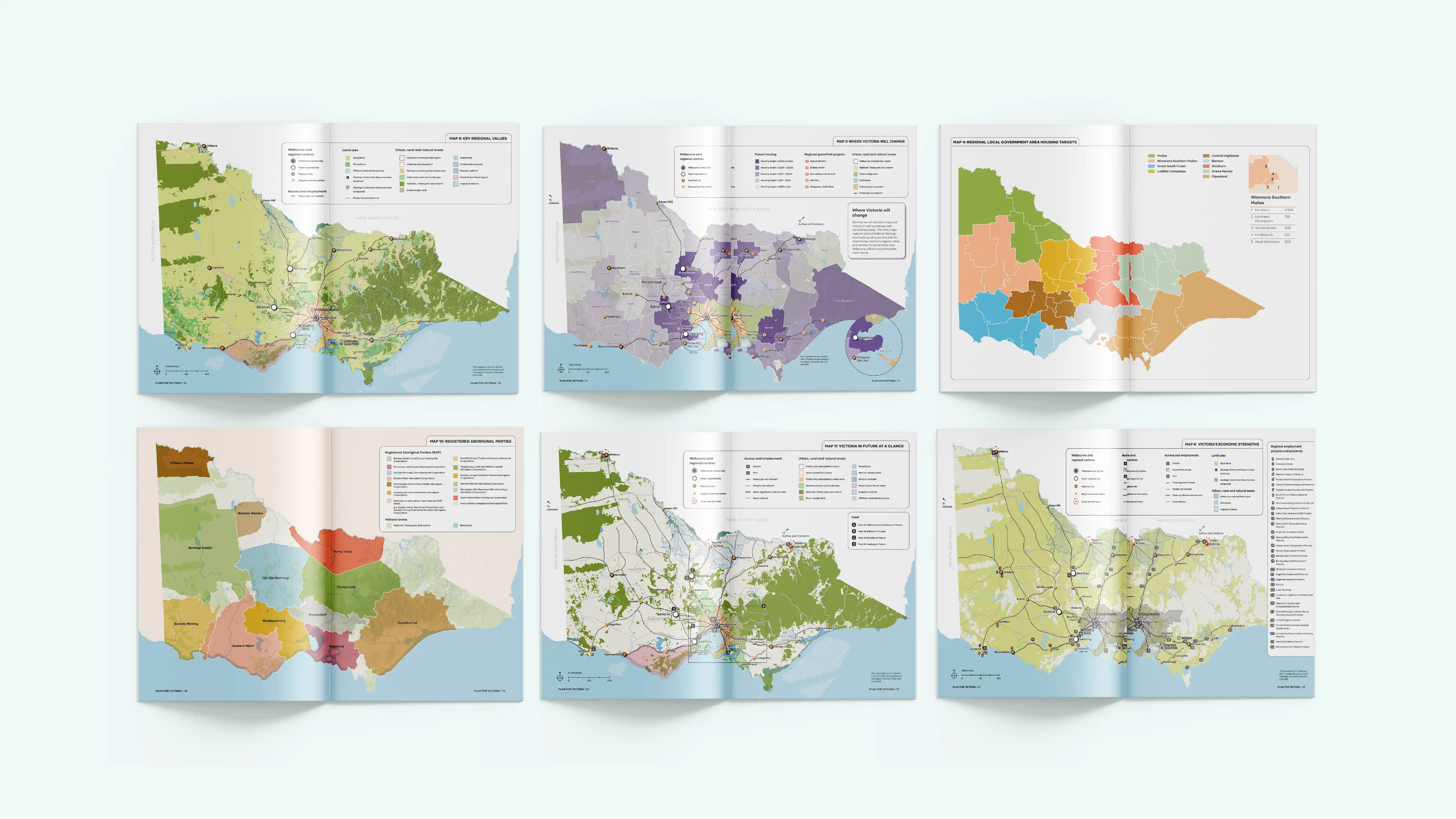
CoFutures developed a suite of strategic maps to translate Plan for Victoria and associated planning reforms into clear, spatial narratives. Our mapping synthesised complex policy settings into legible cartography showing growth directions, settlement patterns and infrastructure relationships at a metropolitan scale. The maps were designed to balance technical accuracy with accessibility, supporting both expert interpretation and public understanding across reports, presentations and engagement material.
Need a map created? Let's chat!
Speak with our expert mapping team. Fill out the form below or get in touch via admin@cofutures.com.au
Thank you! Your submission has been received!
Oops! Something went wrong while submitting the form.